


Creating Altitude-Based Ecosystems with Forest Pack
iToo Software latest tutorial for Forest Pack explains how to use the terrain’s altitude information to create a flexible elevation-based ecosystem for automatically populating large environments.
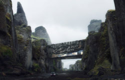
In this tips and tricks episode we’re going to look at how to use Forest Pack’s surface tools to quickly populate entire scenes with ecosystems that adapt according to a terrain’s elevation. In the process we’ll share 11 tips for creating this lake scene that can be applied to scattering geometry and optimising renders to create similar environments.
By completing this tutorial you’ll learn several useful tricks that have a much wider range of applications, including :
- Use the free Glue plugin.
- Restrict scatters based on elevation information.
- Use altitude-based Density and Scale Falloff
- Create and overlap several “layers” of Forest Pack geometry.
- Use complementary distribution maps.
- Use Forest Clusters to add easy to control gaps in the scatter.
And more!
The scene files for this tutorial include the lake starter scene. The majority of this scene can be completed using models included in the built-in library, although Forest Pack 6 is required to use some of the library objects shown.
The supplied files are compatible with 3ds Max 2015 and above and Chaos Group’s V-Ray renderer. Quadspinner’s new tool Gaea was used to model the terrain environment.
See you in the next article 😉
RB.


Test comment